Research is performed using tools developed by the Western Consortium for Watershed Analysis, Visualization and Exploration (WC-WAVE). WC-WAVE is a collaborative program among researchers from many different disciplines in Idaho, Nevada, and New Mexico that seeks to create a Virtual Watershed simulation to more efficiently model and understand actual watershed dynamics.
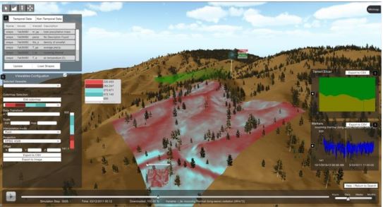
A Virtual Watershed makes it easier for scientists to examine and model environmental conditions in western watersheds. With this tool, users can examine single points of data, or look at values over time. They are also able to create and explore 3-D models, or look at the topography of a two-dimensional slice. This research provides insights into how changes in climate may alter the timing and amount of runoff water in a region.
Researchers at the University of Idaho and University of Nevada, Reno, work together to provide computer simulations in a Virtual Watershed that can be used to efficiently model and analyze environmental data. For example, in the Dry Creek Watershed, Idaho, this approach helps scientists study changes in thermal longwave radiation (i.e., the movement of heat).